What is the Michelin Ecological Reserve?
The Michelin Ecological Reserve (REM or Reserva Ecológica Michelin in Portuguese) is a 3800 ha protected area owned by the Plantações Michelin da Bahia (PMB) member of Michelin Corporate Group whose headquarters are in Clermont-Ferrand, France. The reserve encompasses a mosaic of lowland evergreen Atlantic rain forest and rubber groves in the municipalities of Igrapiúna and Ituberá, 140 km south of the capital Salvador. The reserve is legally classified under several conservation categories including Legal Reserve (Reserva Legal), Conservation Easements (Servidão Florestal), and Private Natural Heritage Reserve (Reserva Particular de Patrimônio Natural). The reserve is part of a larger Michelin project called Michelin Programao Ouro Verde Bahia that includes economic, social, and agronomic research programs aimed at stimulating the regional economy and improving the standard of living of smallholder agriculturalists by planting improved varieties of rubber trees.
Why did Michelin create the reserve?
The Michelin Ecological Reserve was created in 2005 (port. # 13294, decree # 1.922/96) in order to preserve a significant remnant of the southern Bahian Atlantic Rain Forest, known for its rich biodiversity and endemic species, in a region that has suffered widespread deforestation and forest degradation. While protecting the forest from illegal hunting and woodcutting was the principal purpose for creating the reserve, Michelin seized the opportunity to invest in reforestation, ecological research, and environmental education programs after realizing that the lack of such programs is impeding the adequate management and protection of the Atlantic Forest of Bahia. Thus, the reserve is organized around these five programs: protection, restoration, research, environmental education and ecotourism at Pancada Grande Waterfall. The creation of the reserve is part of the Michelin corporate philosophy of the sustainable use of natural resources and environmentally responsible business practices.
Organization of the reserve
The reserve is administered by the Center for Biodiversity Studies (CEB or Centro de Estudos da Biodiversidade in Portuguese) with a staff of eighteen: the reserve director (Dr. Kevin Flesher), administrator (André Sousa dos Santos), five forest guards, a ten man restoration crew, a person to look after the dormitory, and three attendants and a groundskeeper at the Pancada Grande Waterfall.
Who has access to the reserve?
The reserve is a multiple-use area with a zoning scheme to determine the use of each area. Tourism is limited to the Pancada Grande Waterfall. Ornithologists with scheduled visits are allowed access to the wetlands in the plantation in the company of the forest guards and can visit the areas open to tourism without the need to schedule visits or the company of forest guards. Scientists with approved projects and scheduled visits are allowed access to the entire reserve.
Geography
The Michelin Ecological Reserve lies in a region is known as the Costa do Dendê (the Oil Palm Coast) in the Baixo Sul (Lower South) of Bahia. Today the landscape is characterized by a variety of distinct ecosystems including coastal Atlantic evergreen broadleaf rain forest, piaçava (Attalea funifera) restinga forests, jataipeba (Brodriguesia santosii) restinga forests, mangrove-lined estuaries, rivers, wetlands, and the open sea, and diverse agroforestry systems with more than 60 cultivars planted. More than 4,000 forest fragments remain in the vicinity of the reserve, occupying an area of approximately 40,000 ha, with the majority of the fragments <30 ha and the few >500 ha accounting for most of the forest cover. The mixed tree crop landscape of the Colônia lies to the north of the reserve, large rubber/cacao/banana plantations to the east and south, and a 13,000+ ha forest to the west. In the following paragraphs we describe the history of land use, geography, climate, and habitats of the reserve.
History of land use
The region has a long history of human settlement beginning with the shellfish gathering Sambaqui peoples who arrived some 7,000 years ago. We know very little about the subsequent waves of human colonization (none of these peoples left stone monuments or written records) other than that these peoples were hunter-gatherers. The Tupi-Guarani peoples who moved out of the Parana River Basin and up the Atlantic coast some 1,500 years ago introduced agricultural to the Atlantic Forest, probably arriving in the reserve region at least 1,000 years ago. At the time of the Portuguese conquest in the 16th century, the reserve lay on the northern frontier of the Tupiniquin´s territory with the bellicose hunter-gatherer Guerens (a.k.a, Aimorés, Botocudos, Engereckmung) inhabiting the vast forested lands beyond the coastal palisade. While we imagine that the hunter-gatherer peoples had a limited effect on the landscape, the Tupi agriculturalists transformed the forest through their agricultural practices. They planted manioc, maize, beans, squash, peppers, pineapples, sweet potatoes, papaya, tobacco, and cotton in their swiddens with manioc as their staple crop. In doing so, they created a landscape mosaic of forest, fallows, and agricultural plots. The land under fallow may have been extensive as manioc plots are only cultivated for one harvest (1.5 years) and it takes centuries for these sites to revert to old growth forest. It is likely that the Tupiniquin cleared forest in the reserve to plant their crops, because the Cachoeira Grande River is one of the largest rivers in the region and has several kilometers of relatively flat alluvial land along its lower course. Nonetheless, it is clear from early accounts of the Portuguese that the greater landscape was still largely forested after 500-1,000 years of Tupi farming.
By the close of the 16th century, the Tupiniquins were a conquered people, having suffered severe population losses due to prolonged warfare with the Portuguese and recurrent epidemics resulting from introduced diseases. With the population decline, it is likely that much of the former farmland reverted to forest. The fierce resistance of the Guerens kept the Portuguese from penetrating the hinterlands so that pressure on the forest during the early colonial period was limited to a narrow coastal strip. Ituberá was founded in 1682 as an outpost of the Jesuit mission of Camamu, with a subsistence economy based on manioc cultivation and limited timber extraction. Even after the Guerens were finally defeated in the mid-18th century, the region remained a backwater with a small population and agriculture largely restricted to lands within a few kilometers of the coastal towns. As such, it is likely that the reserve’s forests remained largely undisturbed. Likewise, while loggers felled trees in the region throughout the colonial and imperial periods, they mostly restricted timber operations to forests with easy access and are unlikely to have exploited the reserve forests in any significant way. In the late 18th and early19th centuries families of posseiros (farmers living on unused government lands) moved away from the towns and into the hills, clearing forest to plant manioc and bananas and rearing hogs. Some of these families colonized the reserve forests, clearing the flatter lands along the larger rivers and streams and eventually felling forest on the steep hill slopes as well, especially along the Pacangê River Valley. The population density in the reserve remained low throughout the posseiros' tenure, but they had a profound effect on the forest by creating extensive areas of secondary forest and by hunting. Even though the landscape remained largely forested in the mid-20th century, the posseiros had extirpated the tapir (Tapirus terrestris), white-lipped peccary (Tayassu pecari), giant armadillo (Priodontes maximus), and red and green macaw (Ara chloropterus) through over-hunting (and in the case of the white-lipped peccary possibly due to disease transmitted from domestic swine).
The posseiro way of life ended in 1950 with the arrival of the SAICI (Sociedade Anonima Industrial e Comercial de Ituberá) timber mill and wealthy investors who dispossessed the posseiros and carved up the government lands to establish cacao and rubber plantations. This new wave of immigrants radically transformed the landscape, almost completely annihilating the old growth forests and reducing forest cover by more than 50% over the following two decades. Firestone purchased the land on which the reserve lies in 1953 (part of their 9,000 ha property) and felled and burned the forest to plant rubber monocultures, only leaving forest on sites unsuitable for agriculture. Half of what is now the reserve was cleared and still supports a mosaic of rubber trees, wetlands, and narrow gallery forests of pioneer vegetation. The remaining forests were used as a timber reserve and Firestone selectively logged all of the forests for timber to build and maintain the plantation infrastructure. Pacangê (which was not part of the Firestone property) passed through several owners who cleared the southern section of the forest to raise cattle, but most of the forest felled in Pacangê was cleared by the posseiros over the preceding century.
Immigrants flooded into the region to help establish the new plantations and to fell timber for the mill. With many more people now inhabiting the landscape and increased access to once remote areas, hunters harvested game with abandon and wildlife populations crashed. Between 1950 and 1980 hunters extirpated of the jaguar (Panthera onca) and the brown howler monkey (Alouatta guariba) and populations of collared peccaries (Pecari tajacu), capybaras (Hydrochoeris hydrochearis), yellow-breasted capuchin monkeys (Sapajus xanthosternos), coatis (Nasua nasua), agoutis (Dasyprocta leporina), kinkajous (Potos flavus), red-billed curassows (Crax blumenbachii) and other species fell dramatically, disappearing from most of the landscape. Only the marmoset (Callithrix penicillata) and the crab-eating fox (Cerdocyon thous) escaped persecution.
Michelin purchased the property in 1984 and continued to use the landscape much as Firestone had done. Hunters continued to ravage the forests and wood thieves occasionally cut timber and jusara palm (Euterpe edulis). The environmental policies on the plantation changed in the mid-1990s under the tenure of Bertrand Vignes and Bernard Francois who over-saw the purchase of the Pacangê forest in 1999. The situation continued to improve under their successor, Lionel Barré, who organized the legalization of the reserve (2005) and the establishment of the research program (2006). Today, the forest is a strict reserve with only research, environmental education, and limited tourism permitted. Five forest guards patrol the forest and through our wildlife monitoring program we have recorded an increase of 117% in wildlife abundances and the return of the collared peccary, puma (Puma concolor), capuchin monkey, and red-billed curassow to the Vila 5, Pancada Grande, and Luis Inácio forests after decades of absence. The guards have effectively limited hunting pressure to the reserve boundary areas and have eliminated wood theft and jusara cutting.
Physical geography
Topography
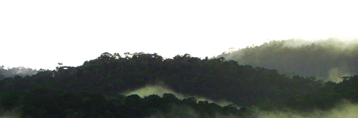
The 3,800 ha reserve is located in the hills along the southern Bahian coast (13º50´S, 39º10´W), 18 km inland from the sea. The reserve forms a narrow 20 km arc, with its widest point reaching 3.5 km and its narrowest not more than 500 m. The property is spread across five ridges aligned on a north/south axis that increase in height from east to west, with peaks between 92-338 m. Hills tend to be steep and flat ground rare.
Waterways
The reserve is blessed with an abundance of springs and waterways. There are three rivers whose courses run through much of the reserve, the largest being the Cachoeira Grande River (a.k.a. Rio Mariana) that passes along the northern reserve boundary and through the Pancada Grande Forest. While this is one of the largest rivers in the region, it is no more than 40 m at its widest and 4 m at its deepest. The river breaks across the coastal hill range as the 61 m Pancada Grande waterfall, one of the most spectacular in the Bahian Atlantic Forest, and joins with the Rio dos Indios briefly before leaving the reserve as the brackish water Serinhaem River. Much of the southern sector of the reserve and the forests of the neighboring Fazenda Itapema I form the headwaters of the Rio Pacangê, which flows through the Pacangê Forest before joining the Cachoeira Grande River to the north. The Rio das Matas is born in a pond between the two southeastern hills of Pacangê and passes through the Luis Inácio and Vila 5 forests, and the agricultural lands to the east before joining the Igrapiúna River. The southeastern hills of reserve form the upper watershed for the Bombaça, Cego, and Barracão rivers all of which flow into the Igrapiúna River. Streams are abundant and the Pacangê Forest has six, the Luis Inácio 2, the Vila 5 Forest 2, and the Pancada Grande Forest 2 major perennial streams, respectively.
Climate
The pleasant climate of the southern Bahian coast has an average precipitation of 2000 mm and daily temperatures between 18˚ and 30˚C, with rainfall throughout the year. There is considerable fluctuation in rainfall between years (range 1313-2666 mm between 1954-2020) and for the same month between years, but in general the heaviest rains fall between February and July, largely coinciding with the austral winter, with the driest period in the summer between August and January. The rains of Santo André, usually falling at the end of November, create a spike in rainfall during the drier part of the year. Patterns of rainfall vary considerably from days when passing clouds bring more than 10 showers to periods when it rains steadily for several weeks. Sometimes in the winter, rain clouds hover over this part of southern Bahia for weeks at a time while other regions of the northeast enjoy sunshine. Strong winds, thunder and lightning are rare events, and there are no hurricanes or tornadoes.
Habitats
The forests habitats
Forests cover some 65% of the reserve concentrated in three large blocks (625, 550, 140 ha). All of the forests were logged and there are no undisturbed or “pristine” forests remaining. Some forests dominated by early succession plant species are clearly forests re-colonizing previously farmed land, while others retain elements of the mature forest community indicating that they were never completely deforested in the 20th century, but rather selectively, even if intensively, logged. Except for those forests consisting entirely of pioneer species, forests are variegated mosaics of vegetation with individual stands of trees reflecting the disturbance history of the site. It is common for forest structure to change over small spatial scales. Table 1 details the five forest types found in the reserve and the percentage of the forest each type occupies of the main forest blocks.
Table 1 Forest classification of the Michelin Ecological Reserve, Bahia, Brazil. List of tree species from Flesher (2012) and Rocha (2011); % = percent of REM three main forest blocks supporting this type of forest (N= 27,050 m of trails).
Other habitat types
Mangrove forests
here is a small patch of mangrove forest at the northeastern edge of the reserve at the mouth of the Canal de Serinhaem. Rhizophora and Avicennia species dominate the mangrove community.
Varzeas (freshwater cattail wetlands)
Low areas along streams that accumulate water create an environment of permanently moist soils ideal for sedges, grasses, reeds, and ferns. Characteristic of these wetlands are dense stands of cattails growing to 1.5-2 m, punctuated with bushes, shrubs and trees on small islands of dry land. The vegetation along the varzea edge is typically a 2-8 m wide dense growth of pioneer trees and bushes reaching 1-12 m. All of the major waterways have varzeas.
Rubber (Hevea brasiliensis) groves
This region is one of the most productive rubber cultivating areas in Brazil, with a large amount of land dedicated to this crop and rubber groves occupy approximately 15% of the reserve landscape. Rubber trees are generally planted at an average density of 476-500 trees/ha with a spacing of 7m x 3m and 8m x 2.5m, respectively. Rubber trees start to be tapped 7 years after planting and once producing can be bled throughout the year, although production drops when the trees change their leaves and during prolonged periods of heavy rain. Cut with a special blade that makes long diagonal grooves in the trunk, the latex bleeds down the groove into a spout and fills a collecting cup attached to the tree with a wire vise. Workers visit each tree every 3-5 days, collecting the condensed rubber in the cup and then cutting a new groove to start the process again, working 850-900 trees/day. Trees can be bled for decades by shifting around the trunk and letting cut sections scar over. Sometimes a hormone is applied to the trees to induce greater productivity.
Michelin abandoned the majority of the reserve rubber groves in 2013/14, with the last remaining groves abandoned in 2021, so that today the REM is strictly a conservation area with no economic activity. Once abandoned the rubber groves are quickly colonized by pioneer vegetation, dominated by species of Miconia, Henrietta, Cecropia, Inga, Didymopanax, Senna, Piper, Solanum, Rauvolfia, Bauhinia, Heliconia, and Cyperus sedges, and vines such as Mikania and several species of Asteraceae. Over the past decade, we have witnessed an increasing recruitment of advanced secondary and primary forest species (Helicostylis, Brosimum, Sloanea, Pourouma, Euterpe, Sapotaceae) in the abandoned rubber groves as the wildlife population recover and disperse seeds into throughout the landscape. To further accelerate the recuperation of the abandoned rubber groves, we have planted 107,000 native forest trees of 275 species in 300 ha of the reserve’s rubber groves as part of our forest restoration program.
Tour of the reserve
Here we present a tour of the reserve starting in the northeastern corner and moving south and west to the southern section (see accompanying map).
Northern tip buffer forest
The northernmost tip of the reserve is a 40 ha buffer zone protecting the main part of the reserve from the urban expansion spreading south from Ituberá. This narrow (200-400 m) band of chronically disturbed pioneer forest flanks BA-001 with the mixed tree crop groves of Fazenda Velha along its western border, the mangroves of the Rio Serinhaem to the east and south, and the low-income Poerão neighborhood to the north. In addition to the forest, there are some 20 ha of abandoned rubber groves.
Road to Pancada Grande
These 60 ha between highway BA-001 and the Pancada Grande Waterfall support rubber groves with inter-rows of a dense pioneer vegetation growing to 2-5 m, and a large area enriched with native forest species planted in 2005, 2008, and 2012. There are several small patches of dense secondary forest, especially along the river and on the approach to the waterfall. The road to the waterfall splits off BA-001 at the confluence of the Indios and Cachoeira Grande rivers and runs along the latter to the waterfall, with a road junction that leads to the Colônia and another that ends at the top of the waterfall. This part of the reserve is 100-400 m wide and 2 km long, with a steep slope rising north of the river. To the north lie the smallholder mixed tree crop groves of the Colônia and to the south large rubber/cacao/banana plantations.
The 625 ha Forest
This 625 ha forest is one contiguous fragment but divided into three parts reflecting the three access point as described below.
The Pancada Grande Forest
The 172 ha Pancada Grande Forest lies on the north bank of the Cachoeira Grande River, between the river and the Colônia. The topography is slightly undulating with an elevation of 120 m along the river and 186 m and 190 m on the two hill tops. This forest was heavily exploited for timber for 25 years between the 1950 and the 1970s. The flatter western section of the forest was the most heavily logged and the upper river trail forest the least. Today the forest consists of 48% heavily logged and 52% medium impact logged forest. There are still small groves of old-growth trees in the center of the forest, but most large trees are Eriotheca spp. and the fast growing Tachigalis, Albizia and Parkia pendula trees. Overall, the upper canopy is 10-15+ m with occasional emergents ≥20 m and the understory tends to be thick to 3-4 m with an abundance of saplings, palms and Heliconias. bromeliads, philodendrons, vines and lianas are most common in the riparian forest. A dense growth of herbaceous vegetation lines the two large and three small streams and climbing bamboo dominates several tree fall gaps along the river. Adjacent agricultural lands of the Colônia support rubber, cacao, banana, and cloves, but several of these farms are abandoned and overgrown with farm bush. During a land invasion in the 1990s, peasants cleared several hectares along the central western boundary and two smaller areas along the river and in the forest core. The invaders also cleared saplings from parts of the riparian forest but these have grown back vigorously.
The River Forest
The 273 ha River Forest flanks the southern bank of the Cachoeira Grande River for 4 km covering mostly flat terrain except at the eastern end above Pancada Grande Waterfall where the hill drops precipitously to the river. This forest was heavily logged until the late 1970s and today consists of dense secondary forest to 8-15 m, with scattered older trees and small patches of relatively intact forest in the areas of more difficult access. The western end of the River Forest was completely cleared and burned for an aborted rubber planting project and today consists of a uniform stand of early secondary forest approximately 40 years old with Pourouma as a canopy dominant. Small patches in the center of the forest below the Vila 5 forest are manioc fallows from the posseiro farms of the first half of the 20th century. A thick band of vegetation lines much of the river with abundant vines, bromeliads, bamboo, ferns and Cyperus sedges. The river here is 9-40 m wide with many exposed rocks when the water levels are low and several rapids and small islands.
The Vila 5 Forest
The 180 ha Vila 5 Forest, 2.5 km long and 800 m wide, covers five hills south of the river with peaks between 160-288 m. The forest served as a timber reserve and a source of gravel used for road maintenance. Today the principal forest types are heavily logged (31.3%), medium impact logging (41%), and lightly logged (14.3%) forests. The central eastern side of the forest burned in the 1960s and today supports a secondary forest dominated by Pourouma, Senna, and Didymopnanax trees and abundant vines and thin lianas accounting for 10.7% of the forest. A small area of 2.7% was a manioc farm in the past. Vila 5 retains the most intact of the reserve forests and the upper slopes of the northern hills support a lightly logged forest with impressive specimens of Sloanea, Caryocar, Virola, Eriotheca, Licania, and Copaifera trees. The forest profile in the younger patches is a continuous growth of thin saplings and medium sized trees to 10-13 m, while in the mature patches the upper canopy is consistently 17-20+m. The southern hill mostly supports a heavily logged forest with trees to 8-13+ m, abundant vines, and deep leaf litter, but on the higher slopes there is an old growth grove. Euterpe edulis palms are abundant throughout as are lianas and other epiphytes, and terrestrial bromeliads cover the large exposed rocks on the hilltops. The Rio das Matas flows through the central part of the forest with a pretty waterfall and cascades along its course. The forest has several springs and small streams along which grow mosses, ferns, and tree ferns. Rubber/cacao/banana groves flank the forest on three sides with the River Forest to the north.
Inter-forest rubber
The area between the three main forest areas occupies some 650 ha of the reserve and supports a mixture of rubber monocultures and varzea wetlands, the latter often lined by a narrow band of pioneer forests. The rubber groves are now all abandoned and dense thickets of pioneer bush growing to 2-10+ m are taking over the plantation. This is the primary site for the forest enrichment project with 107,000 trees of 275 species planted.
Luis Inácio Forest
The 140 ha Luis Inácio Forest covers four steep hills through which flows the Rio das Matas. The 338 m northwestern hill is the highest peak in the reserve. Farmers planted manioc in the central and eastern parts of this forest throughout much of the 20th century and fallows occupy 28.8% of the forest. These secondary forests are dominated by Pourouma, Senna, Albizia, Byrsonima, and Didymopanax trees with an upper canopy of 6-12+m and Euterpe palms conspicuously abundant in the under and mid-stories. The remainder of the forest was logged with 25.8% heavily logged, 37.9% medium impact logged, and 7.6% lightly logged. Most of the forest has an understory of dense sapling thickets with medium sized trees reaching 6-15 m, but on the upper slopes of the northern hills and along the Riacho Caipora there are small groves of mature forest with old growth trees. The Luis Inácio Forest lies 800 m to the west of Vila 5 and 400 m to the east of the Pacangê Forest, and is surrounded by rubber groves with abandoned inter-rows enriched with native tree plantings on the northern and western sides and cacao/rubber/banana plantations on the eastern and southern sides.
Pacangê Forest
The 550 ha Pacangê Forest cloaks 7 steep hills along two parallel ridges with peaks between 240-327 m. Pacangê was farmed since the 19th century, mostly for manioc. Four abandoned cacao groves, jackfruit trees, exotic bamboo, and the remains of manioc processing dams in the forest are evidence of this agricultural history. Today the forest is composed of 3% abandoned pastures, 49.9% fallows, 18.7% heavily logged, 23.3% medium impact logged, and 5.1% lightly logged forest. The forest was completely cleared on the lower hill slopes, all along the river, and all the way up and over the southwestern hill. These areas support secondary forest with a dense continuous vegetation to 3-10 m and in the more mature fallows, the upper canopy reaches 7-15 m. Vines are abundant, bromeliads reach moderate densities, and leaf litter is deep. The vegetation of the north end of the forest is a largely impenetrable sapling thicket, with continuous vegetation to 2-8 m. Another large patch of young secondary forest in the center of the forest extends far up the central hill on the western ridge. The third patch of young secondary forest lies midway up the southeastern slope with dense growth of shrubs and trees to 4-8 m. Logged forests cloak the mid and upper slopes of all but the southeastern hill where the most intact forest is located. Mature lightly logged forest follows the eastern ridge in a narrow but continuous band with an upper canopy reaching 15-25 m and spaced old growth trees reaching 30-40 m. On the upper slopes of the western ridge there are scattered groves of mature lightly logged forest with old growth trees and an upper canopy of 15-25+ m and emergents reaching 40 m. These mature forest patches are rich in large lianas, bromeliads and other epiphytes. An ancient old growth sapucaia (Lecythis pisonis) along the river is the largest tree left in the region and allows one to imagine what the forests were like before the 1950s. The small Pacangê River passes through the center of the forest, flowing out of a large cattail wetland on the south end of the forest and into a rubber-flanked wetland on the north end before entering the Cachoeira Grande River. This forest is the source of six large streams and several small streams and has several ponds that retain water throughout the year. Abandoned rubber groves flank the forest on the north and east and on the south by an abandoned pupunha palm plantation. Pacangê is connected to the largest forest block in the region (13,000+ ha) along its western boundary, and together with the forest of Fazenda Itapema I this is the widest section (5 km) of this forest block.
Southern sector
A steep high ridge runs along the eastern flank of this 700 ha area, with the Pacangê River valley below and the forests of Itapema II to the west. Abandoned rubber groves dominate the landscape, but there is also an extensive network of varzea wetlands and several large fragments of pioneer forest (Senna, Tapirira, Cecropia, Didymopanax, Inga, Vismia, Bauhinia, Piper, Miconia, Henrietta, and Cyperus sedges). There are several native tree enrichment plantings in the rubber groves of the southern sector. To the east lie large cacao/rubber/banana plantations and to the southwest and south mixed tree crop groves and large chronically disturbed forest fragments dominate the landscape.